Hurricane Milton: Latest Updates, Projected Path, and Critical Safety Information for Florida
Hurricane Milton, a formidable and incredibly dangerous storm, continues to churn menacingly in the Gulf of Mexico, posing an imminent and severe threat to Florida’s west coast. Millions of residents are bracing for impact as this major hurricane, having recently fluctuated between Category 4 and 5, currently maintains its destructive Category 4 status. Its anticipated landfall is expected to unleash catastrophic conditions across a wide swath of the Sunshine State, less than two weeks after Hurricane Helene impacted the southern United States. The National Hurricane Center (NHC) in Miami has unequivocally warned that Milton will make landfall as a “dangerous major hurricane,” necessitating immediate and decisive action from all those in its path.
The sheer power and rapid intensification of Hurricane Milton have captured global attention and deeply impacted those tracking its progression. On Monday, October 7, Florida meteorologist John Morales delivered a particularly emotional update during an NBC affiliate WTVJ telecast. Visibly moved, Morales paused, stating, “Incredible, incredible hurricane.” He then added, with tears welling in his eyes, “It has dropped 50 millibars in 10 hours.” This dramatic pressure drop signifies an extremely rapid intensification, indicating the storm’s tremendous energy and destructive potential. Morales concluded, his voice heavy with emotion, “I apologize — this is just horrific.” His heartfelt reaction underscored the extraordinary nature and grave threat posed by Hurricane Milton, highlighting the immense challenges faced by meteorologists in conveying the severity of such an unprecedented event to the public.
As the storm approaches, understanding its current expected impact and the necessary preparations is paramount for residents throughout Florida. The following sections detail critical information regarding Milton’s projected path, anticipated hazards, and essential safety guidelines to help protect lives and property.
Where Will Hurricane Milton Make Landfall? Understanding the Forecast
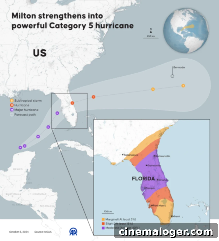
Current projections indicate that Hurricane Milton is most likely to make landfall in the Manatee County/Sarasota County area on central Florida’s west coast. However, meteorologists, including Rick Davis from the National Weather Service in Tampa, emphasize that this is an approximate window, cautioning that the exact landfall point could shift by as much as 50 miles north or south. Davis and other experts strongly advise residents against fixating on the precise center of the forecast cone. Such a narrow focus can create a false sense of security for those just outside the predicted eye, or cause undue panic for those directly within it, leading to potentially dangerous decisions.

“We’re telling people not to focus on the exact center because as the system makes landfall, the eye is going to be getting larger, and the wind field is going to be expanding,” Davis explained. This expansion means that the damaging winds, torrential rainfall, and dangerous storm surge will extend far beyond the immediate eye of the hurricane. “Even if you’re not directly in the path, the effects will be felt far and wide at the point of landfall,” he added. This crucial advisory underscores the importance of heeding warnings for all areas within the broader forecast cone, as significant impacts can be experienced hundreds of miles from where the storm’s center crosses the coast. Preparing for widespread effects, rather than just localized ones, is key to ensuring safety for the maximum number of people.
KNOW YOUR ZONE 🧠: Go ahead and look up your evacuation zone now so you know what to do if evacuation orders are issued. During times of high demand, the system may experience technical difficulties.
Note: this is not the same as a Flood Zone.
🔗https://t.co/ikpK2AjqVz pic.twitter.com/cnrGwFIzh0
— City of Tampa (@CityofTampa) October 5, 2024
What Can Florida Residents Expect from Hurricane Milton?
Hurricane Milton is expected to bring a devastating combination of hazards that demand immediate attention and preparation. Residents should prepare for torrential rainfall, with statewide amounts ranging from 5 to 12 inches. In central to northern areas of the Florida Peninsula, isolated totals could reach an staggering 18 inches. Such extreme rainfall will lead to widespread flash flooding, overwhelmed drainage systems, and potentially significant riverine flooding, threatening both urban and rural areas. The National Hurricane Center has issued urgent advice, emphasizing the need for residents to prepare for prolonged power outages that could last for days or even weeks. Proactive measures to “protect life and property” are crucial, including securing homes, gathering emergency supplies, and ensuring communication plans are in place. Beyond the wind and rain, the storm poses an exceptionally significant risk of “life-threatening” storm surge, which is often the most dangerous and deadly aspect of a major hurricane.
The Grave Threat of Storm Surge and Wind
One of Hurricane Milton’s most perilous threats is the anticipated storm surge. This abnormal rise of water generated by the storm, above and beyond the predicted astronomical tide, can inundate coastal areas rapidly. Category 4 hurricanes can produce storm surges exceeding 10 to 15 feet in some locations, particularly where the coastline is shallow or funnel-shaped. This wall of water can travel miles inland from the coastline, carrying immense destructive power, capable of sweeping away homes, cars, and anything else in its path. For single-story homes in low-lying coastal areas, a significant storm surge can be utterly catastrophic, rendering escape impossible once the water begins to rise.
⚠️WARNING from #Tampa Mayor Jane Castor: “I can say this without any dramatization whatsoever: If you choose to stay in one of those evacuation areas, you are going to die.”
If you are told to evacuate, LEAVE. #Milton
pic.twitter.com/NlzZe8BZzc
— Dena Grayson, MD, PhD (@DrDenaGrayson) October 8, 2024
Tampa Mayor Jane Castor issued an urgent and stark warning to those who have not yet evacuated. Her message was unequivocal, highlighting the extreme danger posed by storm surge: “If you’re in a single-story house and we get a 15-foot surge, the water will come in immediately, and there’s nowhere to go. That home will ultimately become a coffin.” This chilling statement underscores the rapid and overwhelming nature of storm surge, which leaves little to no time for escape once it arrives. She further emphasized the gravity of the situation, bluntly stating that residents choosing to remain in an evacuation area are risking their lives, concluding with the grim reality: “You’re going to die.” These strong words are not meant to dramatize but to impress upon every individual the absolute necessity of heeding evacuation orders to ensure personal safety.
In addition to storm surge, the destructive power of Category 4 winds, sustained at 130-156 mph, will cause widespread and severe structural damage. Homes and businesses may lose roofs, walls, and windows. Trees will be uprooted, and power poles will snap, leading to extensive and prolonged power outages across impacted regions. Debris, propelled by hurricane-force winds, will become deadly projectiles, making outdoor conditions extremely hazardous. Even well-built structures are vulnerable to such intense wind forces. Residents should secure all loose outdoor items, board up windows, and if evacuating, do so well in advance of these dangerous conditions.
Comprehensive Preparedness and Evacuation Directives
Given the severe threats posed by Hurricane Milton, comprehensive preparedness is not just recommended, but absolutely essential. All residents in designated evacuation zones must leave immediately. Authorities have made it clear that emergency services may not be able to reach individuals who remain in high-risk areas during the peak of the storm. Knowing your evacuation zone is a critical first step. Resources are available through local government websites, such as the City of Tampa’s portal, to help residents identify their zone. This is distinct from flood zones and specifically indicates areas prone to life-threatening storm surge.
For those who are evacuating, ensure you have a “go-bag” ready, containing essential documents, medications, chargers, a change of clothes, and non-perishable food and water for at least three days. Fill up your vehicle’s gas tank, withdraw cash, and inform friends or family of your evacuation plans. Consider shelter options, whether it’s a designated public shelter, a hotel outside the impact zone, or the home of friends or family on higher ground.
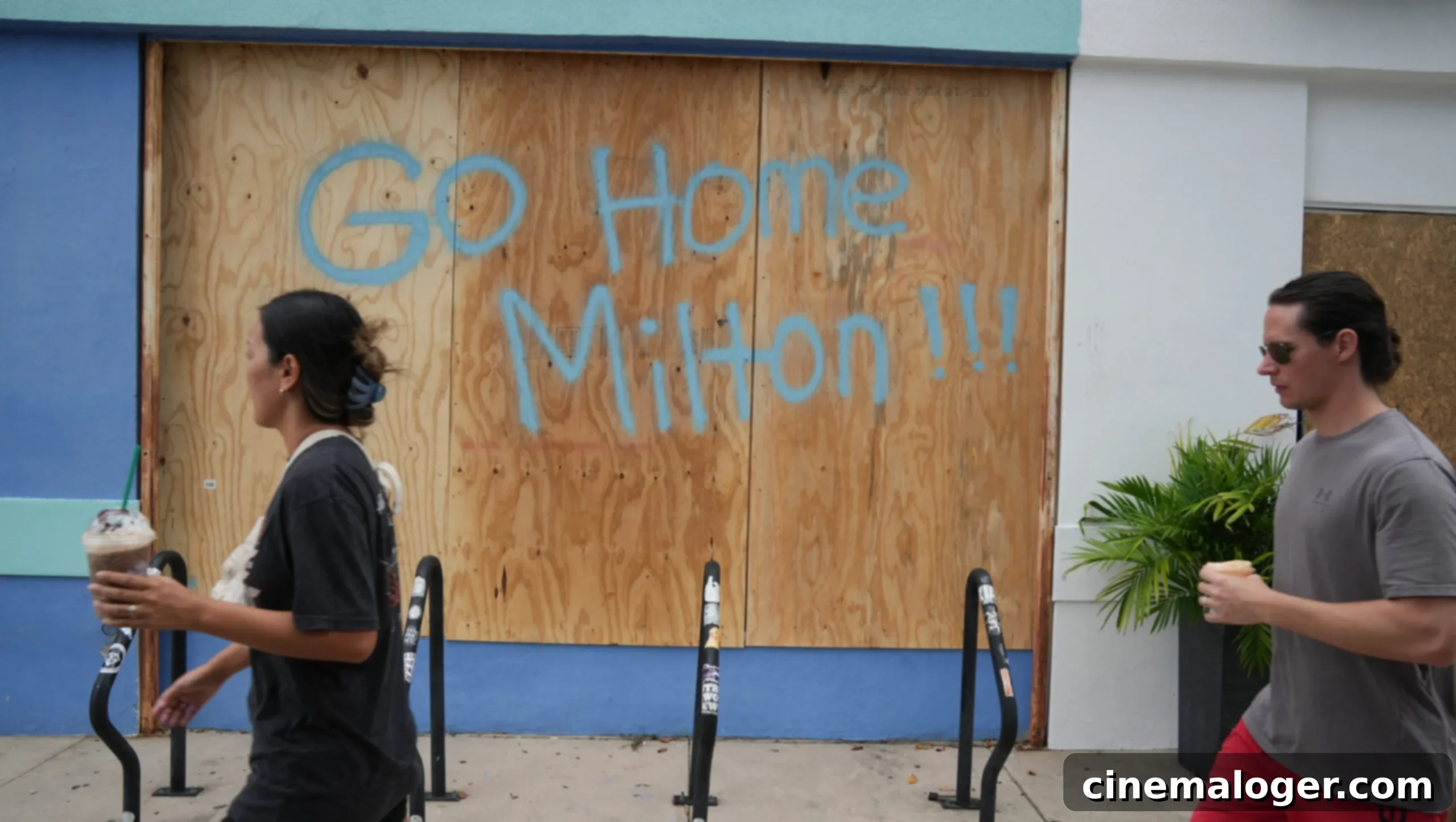
For residents who are not in an evacuation zone but are still within the storm’s broader impact area, preparations should focus on sheltering in place. This includes having ample supplies of food, water, and essential medicines. Ensure all windows are covered with plywood or hurricane shutters, and bring in anything that could become a projectile. Fully charge all electronic devices and have a battery-powered radio for critical updates if power is lost. Be aware that even inland areas can experience significant flooding, strong winds, and power outages. After the storm passes, exercise extreme caution due to downed power lines, flooded roads, and potential structural damage.
The Aftermath and Recovery Efforts
The impact of Hurricane Milton will extend far beyond its immediate landfall. Recovery efforts will be extensive and prolonged. Residents should prepare for a potentially arduous rebuilding process. Following the storm, it is imperative to wait for official declarations that it is safe to return to damaged areas. Avoid contact with floodwaters, which can contain hazardous materials and disease-causing agents. Report downed power lines to authorities and never approach them. Check on neighbors, especially the elderly and vulnerable, once it is safe to do so. Patience and community cooperation will be vital in the weeks and months following this major hurricane.
Hurricane Milton stands as a stark reminder of nature’s formidable power. By understanding the risks, adhering to official guidance, and preparing meticulously, Floridians can significantly enhance their safety and resilience in the face of this dangerous major hurricane. Stay informed through reliable sources like the National Hurricane Center and local emergency management agencies, and prioritize life above all else.
